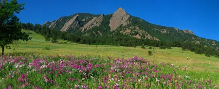
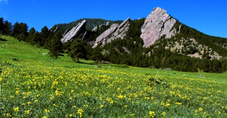
Summer Flatirons with Sweet Pea Flowers Captured 29 June 2013 6:45am
We Boulderites love our Flatirons. In the dozen years that I’ve lived in Boulder, Colorado I have taken hundreds of photos of the Boulder Flatirons but I never knew what created these iconic structures. I dusted off my old (unread) copy of The Geology of Boulder County by Raymond Bridge and tried to figure out how the Flatirons were constructed.
Boulder has witnessed a complex geological history including the rise of two Rocky Mountain ranges, the present day Rockies and about 300 million years ago the Ancestral Rockies. Over the past 150 million years, Boulder’s environment ranged from inland seas to floodplains, deserts, swamps, seashores, then back to floodplain conditions again. Each setting deposited layers of sedimentary rock formed by broken fragments of older rock. Out of this rich geological past grew the set of outcroppings which defined the geomorphic term flatiron. There are flatirons all over the world. Other well developed flatirons in the Western US are found in the eastern Uinta Mountains in northwestern Colorado, the Waterpocket Fold in Capitol Reef National Park and the Superstition Mountains near Phoenix, Arizona.
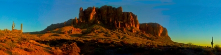
Superstition Mountains Arizona Captured 10 December 2012 @ 5:07pm
The first stage of the construction of the Flatirons was the deposition of a thick layer of sand and gravel which occurred about 300 million years ago when the Ancestral Rockies were completely eroded. Powerful rivers draining these ancestral peaks carried sand and gravel to the adjacent plains, where they accumulated in a massive, 1,000 foot thick sediment that geologists have named the Fountain Formation. The Ancestral Rockies were eventually worn down completely and the eroded material formed younger sedimentary rock layers on top of the buried Fountain Formation. Even our Flatirons are made from recycled materials!
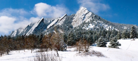
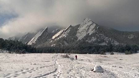
Frosted Flatirons Captured 27 March 2009 @ Noon
The next stage of the Flatiron’s construction is the result of a unique event that occurred 70-80 million years ago known as the Laramide orogeny. This orogeny caused a renewed period of uplift and deformation from Canada to northern Mexico. The easternmost extent of this mountain building is represented by the Black Hills of South Dakota. This type of event is usually associated with the subduction of one continental tectonic plate under another. The subducted plate melts into a hot layer of viscous molten rock deep under the Earth’s crust known as the asthenosphere. In this instance the subduction zone is off the coast of California where it causes faults like the San Andreas as well as earthquakes, volcanos, and the Sierra Nevada mountains. This event also uplifted the modern Rocky Mountains and the western great plains.
How could this event have affected Boulder which is 1000km (600 mi) east of the Pacific ocean? Geologists speculate that a particularly low-angled subduction of one tectonic plate beneath the other caused mountainous bulges deep into the North American continent. These forces pushed up the Flatirons and its neighboring mountains. The subducted plate, known as the Farallon Plate took an unusually shallow angle under the North American Plate. The Farallon Plate did not descend into the asthenosphere in the Earth’s mantle until it moved east causing the upheaval of the Colorado Plateau.
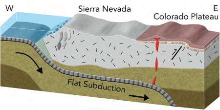
Reproduced From Light Train Productions
The sandwich of layers laid down by the erosion of the Ancestral Rockies and subsequent events were uplifted to their present position by this orogeny. Erosion re-exposed the Fountain Formation on the Flatirons.
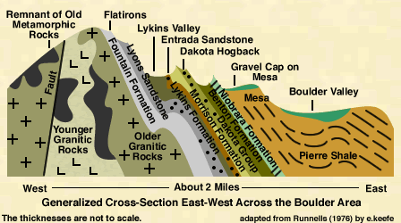
The third event that made the Boulder Flatirons so unique is the cement that hardened them. Although the Fountain Formation stretches the length of the Front Range, Boulder is unique because of its dozens of well formed flatirons. This is due to a geologic quirk. Here, and only here, the Fountain’s layers are held together by an unusually strong cement called adularia, which is called moonstone when it’s gem-quality. This cement formed only in Boulder because on two occasions—about 135 million and 94 million years ago warm, potassium enriched water welled up along an ancient fault zone that stretches between Eldorado Springs and Idaho Springs. The Fountain Formation’s grains reacted with that water to form the adularia that tightly cemented its grains together.
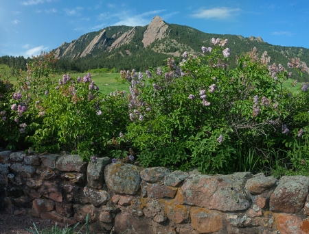
Spring Flatirons with Lilacs Captured 26 may 2016 @ 8:30 am
Another consequence of the uplifting of the Fountain formation is that it occurred on the Western Slope of Colorado as well. In the same way a drawbridge is tilted upward to allow ships to pass, the Rocky Mountains rose tilting up the overlying sedimentary rocks. In fact, the other flank of the “drawbridge” can be seen in Aspen, Colorado on the Western Slope. The iconic Maroon Bells near Aspen form a portion of the Fountain Formation’s western counterpart called the Maroon Formation. Boulder and Aspen are linked by their geological icons.
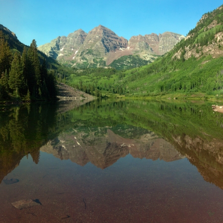
Maroon Reflections Captured 14 August 2013 @ 7:30am
For those who don’t believe all those geologists and their fancy pants scientific theories and speculations here is an alternative explanation for the construction of the Flatirons. This one was created by Jerry McElroy. He graciously gave me permission for the use of this photo and description of an alternative to the fact-based geological explanation…
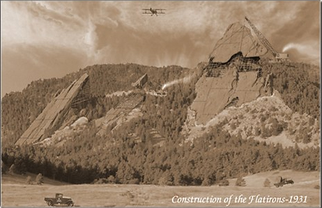
Construction of the Flatirons (click to purchase a print)
The construction of the Flatirons in 1931 was the largest building project undertaken by the Civilian Conservation Corps. This massive development was designed to bring jobs to the Town of Boulder, Colorado and to help promote sagging post-depression tourism. Popular tours inside the Third Flatiron were discontinued in 1948 after a Ranger discovered that the interior space was taken over as a convenient den by black bear.
The last time I searched for photos of the Boulder Flatirons there were about 4,350,000 results! Here are some more of mine…
Cold Flatirons Captured 5 February 2014
Smoky Flatirons Captured 7 September 2010 @ 7:37am during Fire Season!
Flatirons from McClintock Trail Captured 13 October 2014 @ 10:50am
Spring Flatirons with Golden Banner Captured 7 May 2007 @ 10:45am
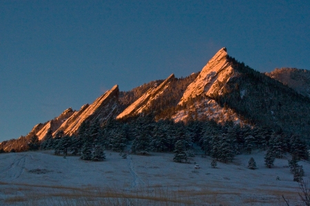
Dawn Flatirons Captured 11 January 2011 @ 7:30am

Mandy the Dog Loved the Flatirons Too. Captured 16 January 2013
I always thought the top of the 3rd Flatiron looks like Mandy the Dog…
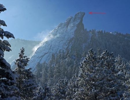
The Mandy Flatiron Captured 2 February 2014 @ 1:25pm
This sculpture of the Boulder Flatirons was created by the late Cydd West a local artist who also used recycled materials to form his Flatirons…
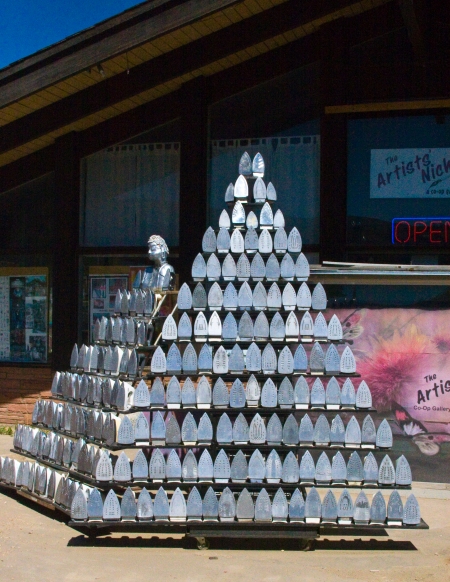
Cydd West’s Flatirons Captured 13 August 2010 at 3:20pm
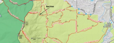
If you’re in Boulder here’s a nice 3 mi / 4.8 km round trip hike to a big flatiron that I call the Red Slab.
The Red Slab from the East
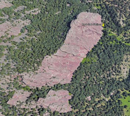
The Red Slab from the Sky (39°57’51.19N 105°17’7.80W)
To get there take the North Fork of the Shanahan Ridge Trail past the Mesa Trail and you’ll walk right up to this massive flatiron (see the push pin in the above satellite image).
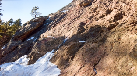
The Red Slab from the Trail

Approach To Slab
The Bottom Of Slab is a Nice Spot to Have Lunch with a Flatiron…
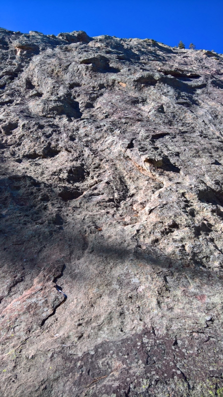
…And Look Up An Ancient Streambed!


